


Lidar-based parking systems use 3D laser data to provide continuous occupancy monitoring and vehicle classification while preserving privacy in smart city applications.
By Dirk Rathsack
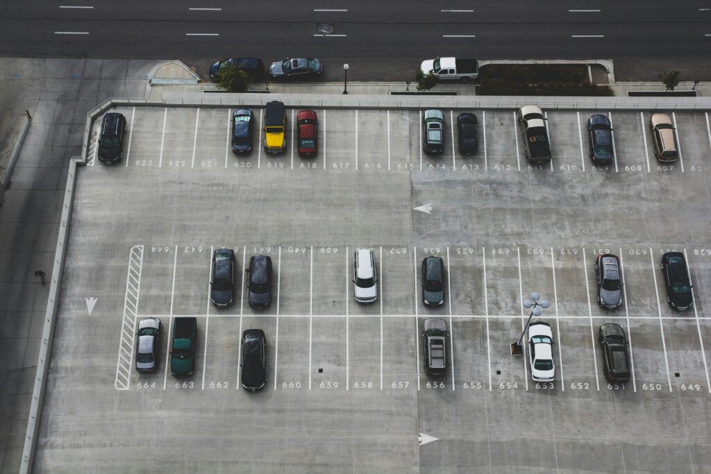
Cities around the world are experimenting with new ways to manage parking more intelligently. In San Francisco, the San Francisco Municipal Transportation Agency uses occupancy data to dynamically adjust parking prices and maintain availability. Barcelona has deployed sensor-based curbside parking systems integrated into its broader smart-city platform, while cities such as Las Palmas de Gran Canaria, in the Canary Islands, monitor thousands of parking spaces using internet-connected sensors. The goal of these initiatives is clear: reduce vehicle congestion, improve curbside efficiency, and make better use of limited urban space.
Despite these advances, many parking systems still rely on fragmented or incomplete data. Ground sensors can be costly to install and maintain at scale, while camera-based monitoring may struggle with lighting conditions or raise privacy concerns. As cities look to expand smart parking programs, the challenge is not only to collect data, but to do so reliably, efficiently, and at scale.
This is where lidar technology is beginning to attract attention in the parking industry. By using pulses of laser light to determine precise 3D information about the physical environment, lidar — which stands for light detection and ranging — can provide a robust data foundation for modern parking management. From occupancy monitoring to vehicle classification, lidar-based systems enable operators to understand parking dynamics with a level of detail that traditional solutions often cannot achieve.
Why lidar is well suited for smart parking management
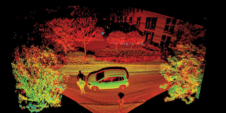
At its core, lidar measures distances using laser pulses. The result is a dense 3D representation of the environment called a “point cloud.” Unlike camera images, these data do not depend on ambient lighting. Instead, they describe the geometry of the surroundings with high precision.
These 3D data offer several advantages for parking applications.
First, lidar provides consistent performance under changing environmental conditions. Darkness, glare, or shadows that can affect camera systems have little effect on laser-based measurement. This makes lidar particularly suitable for outdoor parking areas, garages, and curbside environments where lighting conditions vary throughout the day.
Second, lidar captures physical structure rather than visual appearance. Vehicles, curbs, barriers, and pedestrians are detected as 3D objects. This enables algorithms to identify and track objects reliably without having to first analyze 2D images, which are prone to misinterpretation.
Finally, lidar data supports privacy-friendly monitoring. Because the technology measures distance rather than visual details, it does not capture identifiable features such as faces or license plates, unless additional sensors are used. For municipalities and operators facing strict data-protection requirements, this can be a significant advantage.
Together, these characteristics make lidar a powerful foundation for data-driven parking systems.
Occupancy monitoring with lidar in practice
One of the most immediate applications of lidar in parking environments is occupancy monitoring.
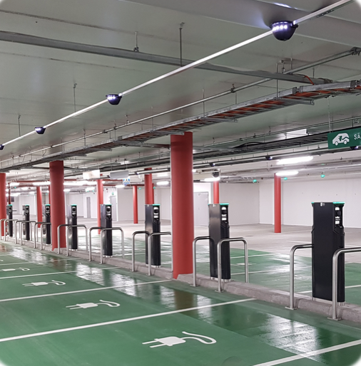
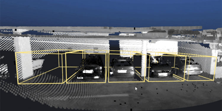
In a typical setup, a lidar sensor is installed on existing infrastructure, such as a light pole or building façade, overlooking a parking area or street segment. The sensor continuously scans the environment and produces a stream of 3D data points. Software processes these data in real time to detect objects, determine their positions, and classify them.
Parking spaces can be marked within the system. When a vehicle enters the monitored area, it is detected in the point cloud, as the sensors register an object where there was none before. The detected points then trigger a change in occupancy. When the vehicle leaves, the space is marked as available again.
Thanks to the detailed nature of lidar data, it is possible to configure thresholds for object size within each detection zone. This ensures that small objects, such as shopping carts, debris, or pedestrians briefly passing through the space, do not trigger false occupancy events. Only when an object exceeds the defined parameters, corresponding to the typical dimensions of a vehicle, is the parking space registered as occupied. This configurable filtering improves detection accuracy and helps maintain reliable occupancy data even in complex environments with frequent movement.
Because lidar captures the full spatial context, a single sensor can often monitor multiple parking spaces simultaneously. In structured environments such as parking garages or well-defined curb segments, one installation may cover an entire section of a facility.
Beyond occupancy: the value of vehicle classification
Although knowing whether a parking space is occupied is useful, understanding what occupies it can be even more valuable.
Lidar-based systems can classify vehicles according to their size and shape. By analyzing the 3D geometry captured in the point cloud, algorithms can distinguish between categories such as passenger cars, vans, trucks, or two-wheel vehicles.
This information opens the door to several practical applications. For example, operators can analyze whether curbside spaces intended for short passenger stops are frequently occupied by delivery vans. Similarly, data about larger vehicles can help cities assess the demand for loading zones or commercial parking areas.
Vehicle classification can also support more effective enforcement. If regulations restrict certain vehicle types from using specific spaces, automated monitoring systems can flag potential violations for review.
In parking garages, classification data can help operators understand how different vehicle sizes affect capacity and circulation. As urban fleets diversify, from compact electric vehicles to larger delivery vans, these insights become increasingly relevant for facility planning.
Importantly, these analyses rely on 3D characteristics rather than visual identification. The system recognizes that an object has the dimensions and shape of a van or a truck, without needing to read license plates or capture visual details.
Smart monitoring of truck parking along highways
The following example illustrates how lidar can unite these capabilities, combining reliable occupancy monitoring with vehicle classification in a real-world parking application.
Although urban parking often receives the most attention, similar challenges exist along highways. The growing volume of freight traffic across Europe has led to a significant shortage of safe truck parking spaces at rest areas. To address this issue, the European Commission’s Safe and Secure Truck Parking Areas framework defines strict requirements for infrastructure, safety, and operational management at truck parking facilities.
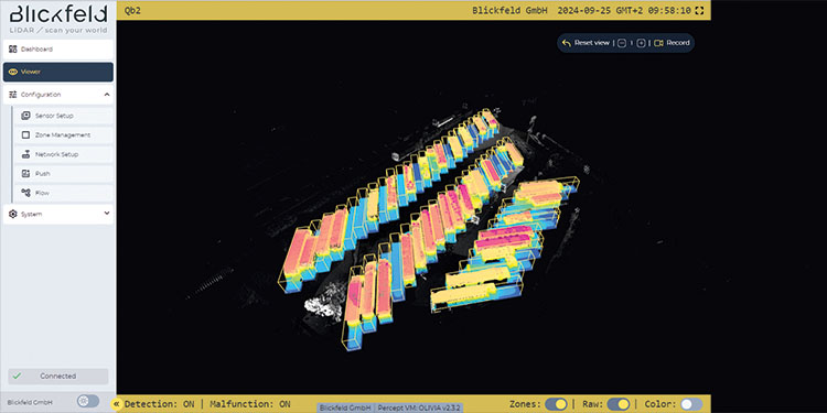
At one highway rest area, a lidar-based monitoring system was deployed to track the occupancy of 60 truck parking spaces in real time. Eleven sensors monitor the parking area and define individual detection zones for each space. The system analyzes the 3D point cloud to determine whether a space is occupied or vacant, updating the information every 10 seconds.
The data is integrated into on-site and online availability displays, enabling drivers to check parking availability before entering the rest area. By analyzing object volume and size, the system can also distinguish between trucks and smaller vehicles occupying truck spaces, an important capability where unauthorized parking by cars or vans further reduces already limited capacity.
The system has proven reliable even under challenging weather conditions such as rain or snow. By providing real-time occupancy information, it helps drivers quickly locate available spaces, reduces unnecessary circulation within the rest area, and lowers the risk of hazardous parking along highway ramps or shoulders.
Building the data layer for future parking systems
The parking industry is gradually shifting from static infrastructure to dynamic, data-informed management. This requires balancing competing demands, including private vehicles, deliveries, shared mobility, and public space, within limited curb and parking capacity.
Reliable, high-resolution data is essential for this transition. Lidar technology contributes to this emerging data layer by offering precise spatial information about how parking areas are used in real time. Occupancy monitoring provides visibility into availability and turnover, while vehicle classification adds context about the types of vehicles involved.
Together, these insights can support a wide range of operational and planning decisions, from adjusting pricing and regulations to designing future parking facilities.
As cities continue to rethink the role of parking within the broader mobility ecosystem, technologies that provide accurate, privacy-conscious data will play an increasingly important role. Lidar is quickly emerging as one of the tools that can help operators see parking infrastructure in a fundamentally new way.
DIRK RATHSACK is the vice president of sales and business development for Blickfeld. He can be reached at [email protected].